Dig Diary 21: A Tour of the Excavation: Part One
March 14, 2016
A Virtual Guide to the Site
Since the beginning of the excavation we have always wanted to show as many people as possible around the site and share its archaeology. However, the location of the site in a working quarry and a small excavation team means we are only able to offer a set number of group visits. While this will never match the full impact of seeing the site in person, we hope it can provide a better sense of the settlement and its preservation.
Introduction
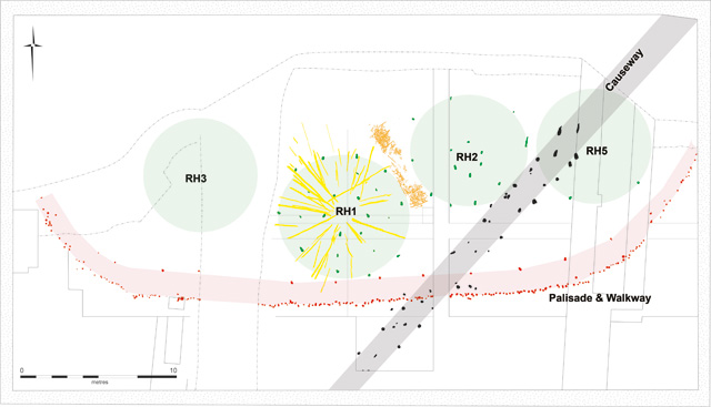
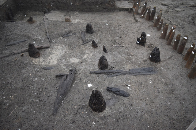
Simplified site plan showing the overall excavation. Areas marked in green are roundhouses, the palisade enclosing the settlement is marked in red and the earlier timber causeway is highlighted in grey. The dot-dash line closest to the top of the image (north) shows the edge of the quarry where more of the settlement would once have been.
The most immediate aspect of the site to make clear is that it is not complete. Quarrying work in the 20th Century seems to have removed approximately half of the settlement: an approximation based on the shape of the remainder of the exterior palisade. The area on the plan, close to RH3, running north to south is a drainage channel which removed a portion of the site when it was dug, again in the mid-20th Century. While this is unfortunate, it is only due to the remains of the quarrying activity from this period that the site was even identified in the first place. Thankfully, this modern intrusion missed the largest roundhouse, leaving us with at least one, large well-preserved structure.
The section on the plan running north-south with straight edges, close to RH5, shows the outline of our initial work in 2006 when we evaluated the material from the site. It shows how small an area we were initially working on, which is relatively common for archaeological evaluations. From this we had to try and predict what we would discover when opening up a larger area. Given the incredible density of wood it would have been hard to guess that it could be so full of material, even in our most optimistic estimations!
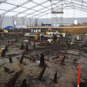
The Western Area – Palisade, Wheel and a House?
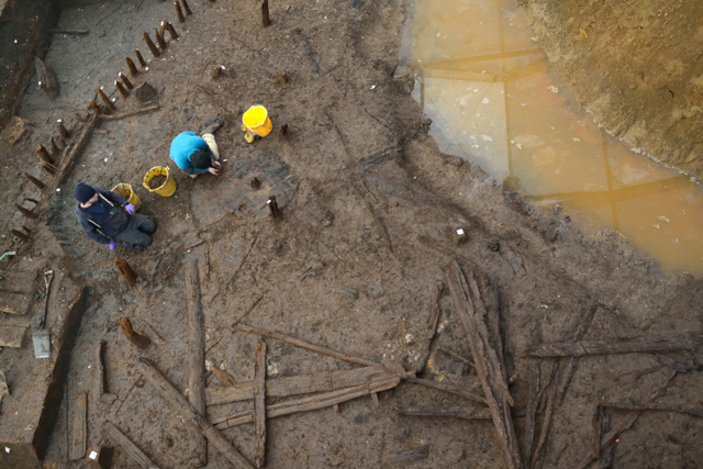
Overview of Western Area with the team working on the wheel
Looking at the western area of site highlights several points. The first of which is the preservation conditions here. The close proximity to the historical quarry edge seems to have had an effect on the waterlogging here, as the wood is more degraded than other areas of the site. Thankfully the condition of the wood is still good enough to be able to examine and record. This is one of the reasons we are excavating the site, to ensure that important environmental and archaeological information is not lost to decay resulting from changes to the water levels.
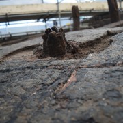
It’s from this area that our wheel emerged giving us a number of interesting issues to consider. Firstly, that it sits in the sediment of the river channel, contemporary with burnt debris from the fire that marked the end of the settlement. The radiant charring on the surface of the wheel strongly implies it was close to the fire that burnt down the houses. Crucially, this charring suggests it was not actually in the blaze. Perhaps the most pressing, and elusive, question is simply “Why is the wheel in a river channel?”. We have had a number of different theories and suggestions but, so far, none of them seems especially probable. We’re hoping that more information might come to light as we excavate more of this western portion of the settlement.
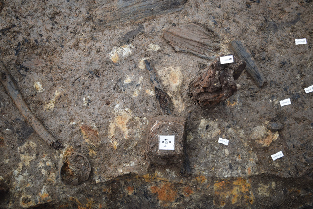
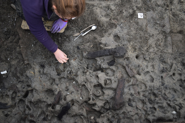
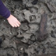
Western Area: patches of burnt clay with remains of ceramic vessel that seem associated with RH3
Finally, there seems to be the remains of a house in this area. It is not particularly easy to identify but a small area of upright posts and clusters of charred timbers suggest that a roundhouse was present. It is likely that the drainage channel has remove some of the structure, making it less noticeable than some of our larger, intact buildings. We’ll find out more about this stilted roundhouse as we work on the area and start to take a closer look at the timbers associated with it.
Over the coming weeks we’ll be exploring the deposits beneath the wheel, recording and removing the timbers and examining patches of burnt clay along the edge of the drainage channel.
The Eastern Area – Palisade and Timbers
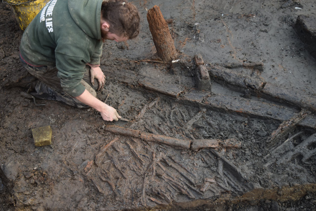
Eastern Area: Uncovering wattle sheets most likely related to RH5
We have just begun to open up this area of the excavation, located to the right of RH5, which is one of the smallest segments of our project. The southern area, outside the extent of the palisade doesn’t seem to have much timber associated with it, although we need to remove more sediment to check it more thoroughly. Inside the palisade in this area, even though it is relatively tiny, is very busy with archaeology.
There are the remains of a wattle sheet which is slightly decayed alongside several larger timbers. One particularly interesting timber has three mortice holes located very close to one another. It is likely that these timbers belonged to a structure that was partially excavated in the 2006 evaluation trench nearby. It also seems that the footprint of the raised roundhouse extends slightly into the central eastern area close-by, with a few of the posts from the outer ring still visible in place.
Eastern Area: Footprints emerging outside the palisade as it curves
We knew there was some form of structure present in the 2006 trench, however given the small insight this narrow slot provided into the entire settlement, it would have been almost impossible to have identified it as a stilted house. It was initially interpreted as a “timber platform”, which is where the project derives its name from. This goes to show the importance of being able to carry out an open area excavation and how that extra visibility makes interpretation and understanding easier.
We are still at a fairly early stage of excavating the eastern portion of the settlement. Our next plans for this area are to continue to remove the sediment and to clean and record the emerging timbers.
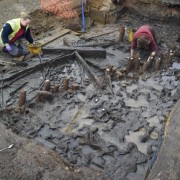
Southern Extension – Timber Causeway and Footprints
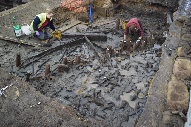
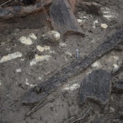
Southern Extension: Large oak causeway uprights emerging from the sediment
To the south of the central area of the excavation, at the end of the highlighted grey causeway, we carried out a small extension to explore a series of very substantial, oak posts. Several of these enormous timbers were discovered during the evaluation and it became apparent that they ran across the settlement, continuing beyond the extent of the palisade. Dating evidence from 2006 revealed that these large oaks were early in date with dendrochronology giving a feeling date of 1292BC, whereas the palisade was radiocarbon dated to between 1000 – 800BC.
As we uncovered and cleaned the palisade it became clear that the large oaks continued we took the decision to extend the excavation area slightly. This proved very worthwhile and revealed five more oak uprights alongside some other wooden debris. These oaks seem to have formed a wooden causeway that would have run across the landscape in a similar manner to the Flag Fen causeway. The dates of the earliest timbers at Flag Fen and Must Farm are only a few years apart, suggesting timber construction on a landscape scale.
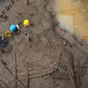
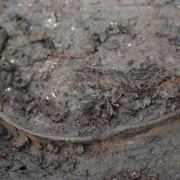
Southern Extension: cleaning footprints in the sediment outside the palisade
This extension also revealed footprints pressed into the soft sediments of what would have been the edge of the river during the Bronze Age. We found areas of footprints outside the palisade during the evaluation and these most recent ones are of similar quality. They are preserved when the indentations of the footprint are filled with the shelly river silts. This keeps the shape very well allowing us to remove the shell-rich silt and reveal whole areas of activity. We’ve got a nice variety of different impressions: including sheep and cows as well as human footprints.
In the next part of the tour we’ll be discussing the archaeology of the central areas and more information about the stilted roundhouses we’re beginning to explore.
Related stories
Dig Diary 24: Visualising the Site
April 4, 2016
Dig Diary 23: Footprints and Posts
March 28, 2016
Dig Diary 22: A Tour of the Excavation: Part Two
March 21, 2016
Dig Diary 21: A Tour of the Excavation: Part One
March 14, 2016
Dig Diary 20: Excavating in the Fenland Landscape
March 7, 2016
Dig Diary 19: Discovering Britain’s Oldest, Complete Wheel
February 29, 2016
Dig Diary 18: Looking Inside and Outside Roundhouse One
February 22, 2016
Dig Diary 17: Formality and the Must Farm Settlement
February 15, 2016
Learn more
About
Publications
Post-Ex Diaries
Our work on-site has finished but lots more investigation is taking place as we study both the material and the evidence we recovered. ...read more
Discoveries
See some of the discoveries from the Must Farm pile-dwelling settlement.
Making Must Farm
Find out about our work with AncientCraft recreating Must Farm’s material.
FAQs
Further information on the Must Farm project.